


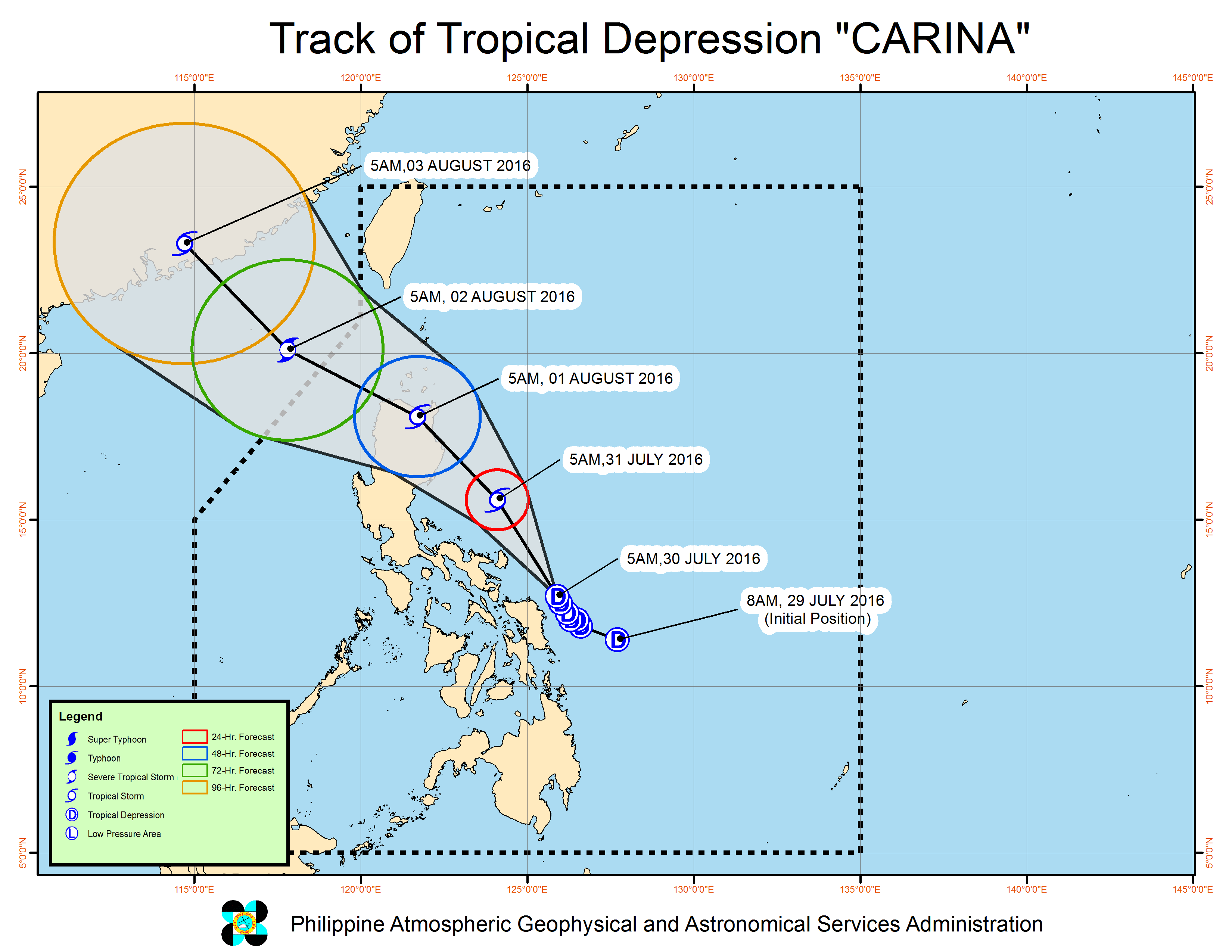
Tropical depression "Carina" has maintained its strength with a maximum sustained winds of 55 kph near the center, but has slightly accelerated at 11 kph heading northwest, the Philippine Atmospheric, Geophysical and Astronomical Services Administration (PAGASA) said Saturday morning.
Moderate to heavy rainfall may be expected within 300 km diameter of the tropical depression, and fisherfolk are warned against moderate to rough seas over the eastern board of Luzon and Visayas.
Catanduanes, Camarines Sur, Albay, Sorsogon, northern and eastern Samar are still under Tropical Cyclone Signal Warning No. 1.
These areas, the rest of Visayas, Camarines Norte and Masbate are warned against moderate to heavy rains which may trigger flashfloods and landslides.
The center of "Carina" was last eyed at 140 km east of Catarman, northern Samar.
Rains with gusty winds will be experienced over Catanduanes, Camarines Sur, Albay, Sorsogon and the provinces of Samar. Cloudy skies with moderate to heavy rains and thunderstorms which may trigger flashfloods and landslides will prevail over the rest of Visayas.
Cloudy skies with light to moderate rains and thunderstorms is aldo expected over Metro Manila, CALABARZON, MIMAROPA, Northern Mindanao and the rest of Bicol region. Partly cloudy to cloudy skies with isolated rainshowers or thunderstorms will prevail over the rest of the country.
On the other hand, moderate to strong winds blowing from the west to southwest will prevail over Mindanao and the rest of Visayas and coming from the northwest over the rest of Bicol region. The coastal waters along these areas will be moderate to rough.
Elsewhere, winds will be light to moderate coming from the northeast to north with slight to moderate seas. (PNA)